When The Lost Rainforests of Britain campaign began in March 2021, Guy Shrubsole knew that Britain had once been home to large expanses of temperate rainforest and set out on a journey to bring these unique habitats back. This began with a public call to action to help map Britain’s lost rainforests.
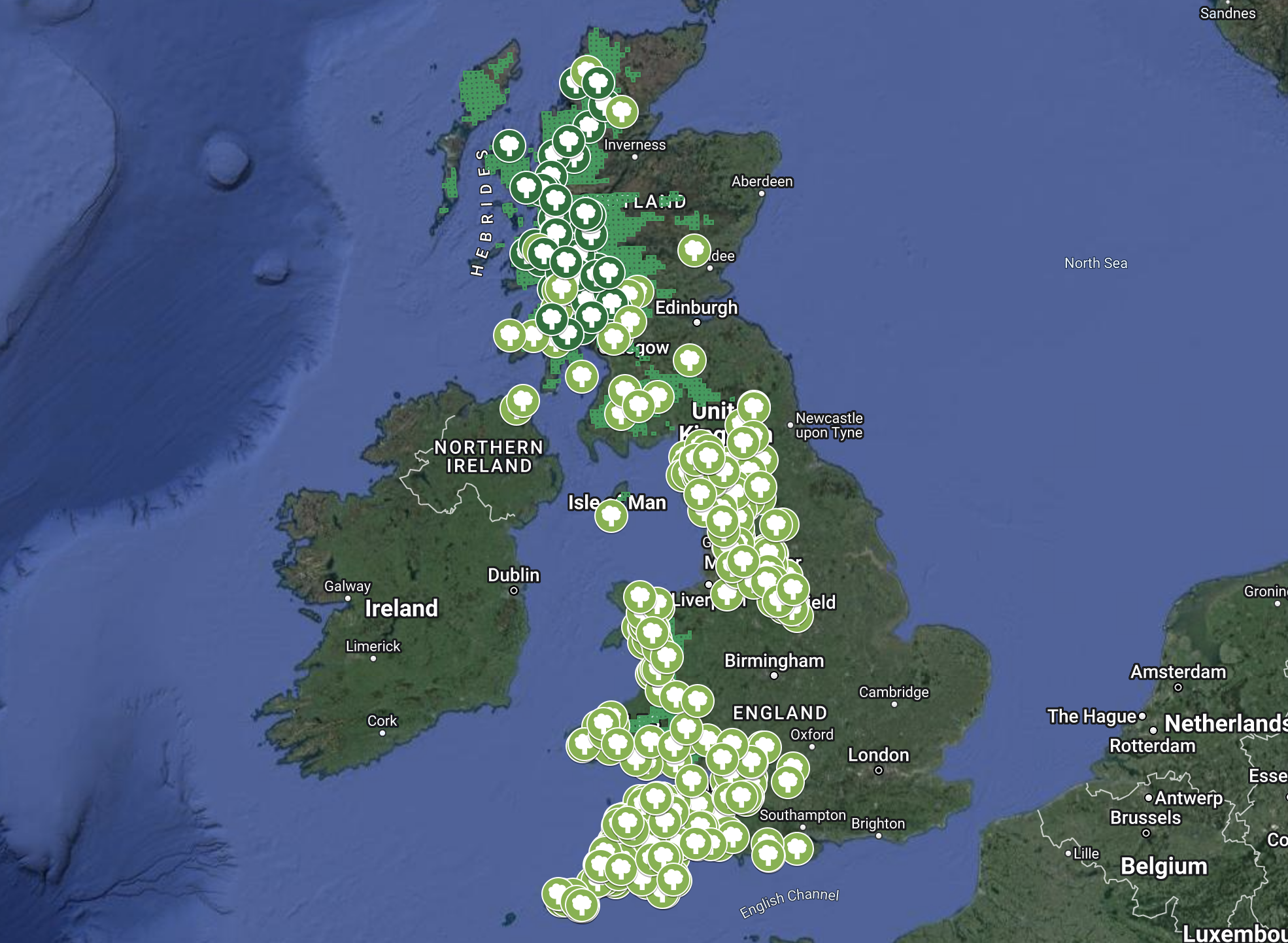
Over the past year and a half, members of the public have sent in hundreds of submissions, with photos and details of where they think they have found fragments of temperate rainforest. We would like to extend a huge thank you to everyone who has got involved with this campaign and sent in a submission (all of the photos submitted can be found here). Your submissions help to demonstrate to Government that there is public interest in protecting and restoring temperate rainforest and that it should be considered a priority habitat. The updated map can be seen below:
Over the past year and a half there has been an amazing amount of public support and interest in Britain’s temperate rainforest, and we hope this continues to grow and that more people get the chance to visit one of our beautiful rainforests.
Earlier this year, we published a map of temperate rainforest revealing the extent of Britain’s surviving fragments of temperate rainforest and the rainforest zone, by combining datasets on rainfall, ancient woodlands and species records.
The map of public submissions complements this by showing real life examples and photos submitted by the British public.
We would like to thank Fern Owen for inputting the submissions into the map over the past few months.
Finally, we are closing the submission form and won’t be adding further entries to the map going forward, but do continue to share and tag us at @LostRainforests on Twitter and Instagram in any rainforest photos you post!

A question. Is there a threshold for how much rainfall and the type of species to qualify as a rainforest. Some places on this map such as Exeter and Swanage are fairly dry and tend to be quite lowland in vegetation.
LikeLike
Hello Guy, I hugely enjoyed your book, a great clarion call. But I wondered if you were aware of this project which I was privileged to be involved with 20 years ago: https://swla.co.uk/projects/aig-an-oir-at-the-edge It was truly ground breaking in its time. Also, are you aware of John McGrath’s hugely influential play of 50 years ago, The Cheviot The Stag and the Black Black Oil which first brought to wide public attention the history of the Clearances in the Highlands of Scotland, and the roles played by sheep and deer?
LikeLike